ENSEIGNEMENT
ITI - Initiation au Traitement d'Images
| Cours | Initiation au Traitement d'Images | SR-ITI-COURS-02-09.pdf | SR-ITI-COURS/ | |
|
|
|
|
|
|
| TD |
N° |
Sujet |
Support |
Fichiers nécessaires |
|
|
1 |
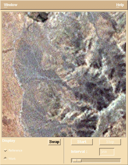
Visualisation d’images sous X-Windows |
||
|
|
2 |
Statistiques des images |
||
|
|
3 |
Animation – seuillage -stretching |
||
|
|
4 |
Utilisation d’une LUT – Stretching automatique |
||
|
|
5 |
Traitement radiométrique global par adaptation de l’histogramme à un modèle |
||
|
|
6 |
Filtrage par convolutions |
||
|
|
7 |
Filtrage par convolutions – Filtrage médian – Variations locales |
||
|
|
8 |
Statistiques locaux et traitements locaux |
||
|
|
9 |
Traitement géométrique |
||
|
|
|
|
|
|
| Examens | Année | Enoncé | Corrigé | |
| |
|
1999-2000 - M1 Informatique (UPEMLV) |
|
|
|
|
|
2000-2001 - M1 Informatique (UPEMLV) |
|
|
|
|
|
2001-2002 - M1 Informatique (UPEMLV) |
|
|
|
|
|
2002-2003 - M1 Informatique (UPEMLV) |
||
|
|
|
2003-2004 - M1 Informatique (UPEMLV) |
||
|
|
|
2004-2005 - M1 Informatique (UPEMLV) - ITI1 (6 séances) |
||
|
|
|
2004-2005 - M1 Informatique (UPEMLV) - ITI2 (12 séances) |
||
|
|
|
2005-2006 - M1 Informatique (UPEMLV) |
||
|
|
|
2006-2007 - M1 Informatique (UPEMLV) |
||
|
|
|
2007-2008 - M1 Informatique (UPEMLV) |
||
|
|
|
2008-2009 - M2 SIG (ENSG) |
||
|
|
|
2008-2009 - M1 Informatique (UPEMLV) |
||
|
|
|
2009-2010 - M2 SIG (ENSG) |
||
|
|
|
2009-2010 - M1 Informatique (UPEMLV) |
||
|
|
|
2010-2011 - M2 SIG (ENSG) |
||
|
|
|
2010-2011 - M1 Informatique (UPEMLV) |
||
|
|
|
2010-2011 - Calcul Numérique et Scientifique (Ingénieurs 2000) |
||
|
|
|
2010-2011 - Master IASIG (Université de Douala, Cameroun) |
||
|
|
|
2011-2012 - M2 SIG (ENSG) |
||
|
|
|
2011-2012 - M1 Informatique (UPEMLV) |
||
|
|
|
2012-2013 - M1 Informatique (UPEMLV) |
||
|
|
|
2013-2014 - M1 Informatique (UPEMLV) |
||
|
|
|
2014-2015 - M2 IG (ENSG) |
||
|
|
|
2015-2016 - M2 IGAST (ENSG) |
||
| Projets | Année | Enoncé | ||
|
|
|
2000 |
|
|
|
|
|
2001 |
||
|
|
|
2002 |
||
|
|
|
2003-2004 |
||
|
|
|
2004-2005 |
||
|
|
|
2005-2006 |
||
CATI - Cours Avancé de Traitement d'Images
| Projets | N° |
Sujet | Enoncé | Données |
|
|
01 |
Estompage de MNT |
|
|
|
|
02 |
Déformations par facettes | SR-CATI-PROJET-02.pdf | contribution des étudiants |
|
|
03 |
Fusion Radar + Optique - Maroc | SR-CATI-PROJET-03.pdf | fusion_maroc_asar , fusion_maroc_landsat.1 , fusion_maroc_landsat.2 , fusion_maroc_landsat.3 , fusion_maroc_snap02_win02_x2_anim.gif contribution des étudiants |
|
|
04 |
Stretching local par seuillage automatique | SR-CATI-PROJET-04.pdf | contribution des étudiants |
|
|
05 |
Fusion Radar + Optique - Italie | SR-CATI-PROJET-05.pdf | fusion_italy_ers , fusion_italy_landsat.1 , fusion_italy_landsat.2 , fusion_italy_landsat.3 contribution des étudiants |
|
|
06 |
Démarquage d'images | SR-CATI-PROJET-06.pdf | SR-CATI-PROJET-06_Demarquage_images_Croix-Rouge.mht , SR-CATI-PROJET-06_Demarquage_images_Croix-Rouge_images.zip contribution des étudiants |
|
|
07 |
Yeux rouges | SR-CATI-PROJET-07.pdf | SR-CATI-PROJET-07_yeux_rouges/ , contribution des étudiants |
FUSION - Fusion des données hétérogènes
| Cours | Fusion des données hétérogènes | SR-FUSION-COURS-01-09.pdf | SR-FUSION-COURS/ | |
|
|
|
|
|
|
| Examens | Année | Enoncé | Corrigé | |
|
|
|
2004-2005 - M2 SIG (ENSG) |
||
|
|
|
2006-2007 - M2 SIG (ENSG) |
||
|
2006-2007 - M2 SIG (ENSG) |
||||
|
2007-2008 - M2 SIG (ENSG) |
||||
|
2008-2009 - M2 SIG (ENSG) |
||||
|
2009-2010 - M2 SIG (ENSG) |
MNT - Modèles Numériques de Terrain
| Cours | Modèles Numériques de Terrain | SR-MNT-COURS-01-07.pdf | SR-MNT-COURS/ | |
|
|
|
|
|
|
RADAR - Initiation à l'imagerie Radar d'Observation de la Terre
| Cours | Initiation à l'Imagerie Radar d'Observation de la Terre | SR-RADAR-COURS-01-04.pdf | ||
|
|
|
|
|
|
Télédétection
et Information Géographique
| Cours | Télédétection et Information Géographique | SR-TIG-COURS-01-21.pdf | SR-TIG-COURS/ | SR-TIG-TP/ | |
|
|
|
|
|
|
|
| TD | Sujet | Support | Fichers nécessaires | ||
|
|
|
Programme et modalités de contrôle |
|||
|
|
|
1 - Découverte de Google Earth |
|||
|
|
|
2 - Introduction aux placemarks |
|||
|
|
|
3 - Visite et géoréférencement des images |
|||
|
|
|
4 - Qualité de localisation relative - Traitement d'images (1) |
|||
|
|
|
5 - Traitement d'images (2) |
|||
|
|
|
6 - Conception de rendu HTML dans les scripts KML |
|||
|
|
|
|
|
|
|
| Examens | Année | Enoncé | Corrigé | ||
|
|
|
2004-2005 - Initiation aux SIG et Géodésie |
|||
|
|
|
2005-2006 - Initiation aux SIG et Géodésie |
|||
|
|
|
2005-2006 - Cartographie spatiale |
|||
|
|
|
2010-2011 - Introduction à la Géomatique (Ingénieurs 2000) |
|||
|
|
|
2010-2011 - Utilisation et programmation des globes virtuels (ENSG) |
|||
|
|
|
2010-2011 - Utilisation et programmation des globes virtuels (ENSG) |
|||
|
|
|
2011-2012 - Utilisation et programmation des globes virtuels (ENSG) |
|||
|
|
|
2011-2012 - Globes virtuels - M1 Informatique (UPEMLV) |
|||
|
|
|
2012-2013 - Utilisation et programmation des globes virtuels (ENSG) |
|||
|
|
|
2013-2014 - Projet "La Barquera" de statistiques de vent dans le Golfe d'Aquitaine |
|||
|
|
|
2013-2014 - Globes virtuels - M1 Informatique (UPEMLV) |
|||
|
|
|
2013-2014 - Utilisation et programmation des globes virtuels (ESIPE) |
|||
|
|
|
2014-2015 - Utilisation et programmation des globes virtuels (ENSG) |
|||
|
|
|
2019-2020 - Storyboard avec Google Earth (DUT d'Informatique 2ème année) |
|||
UTA - Conférences Université à Tout Âge
| Conférences | 01 - La Terre vue de satellites | SR-UTA-CONF-01.pdf | ||
| 02 - Le changement climatique vu de l'espace | SR-UTA-CONF-02.pdf | SR-UTA-CONF-02/ | ||
| 03 - Les données d'OT au service du développement | SR-UTA-CONF-03.pdf | SR-UTA-CONF-03/ | ||
|
|
|
|
|
|
Toutes ces images sont d'accès public, fournies au format BSQ sans annotations (matrice simple), sur 8 bits non signés (sauf indications contraires) et stockées ligne par ligne (balayage TV). Pour les images possédant plusieurs canaux (par exemple léna), le premier correspond généralement au bleu, le second au vert et le dernier au rouge.
| Nom de l'image |
Nb de lignes |
Nb de colonnes |
Profondeur des données |
Taille de chaque canal |
Canal 1 |
Canal 2 |
Canal 3 |
|
|
|
|
|
|
|
|
|
| |
1500 |
1500 |
8 bits |
2 250 000 |
|
|
|
| |
1500 |
1500 |
8 bits |
2 250 000 |
|||
| |
2000 |
2000 |
8 bits |
4 000 000 |
|
|
|
| |
2000 |
2000 |
8 bits |
4 000 000 |
|||
| léna |
512 |
512 |
8 bits |
262 144 |
|||
| mandril |
? |
? |
8 bits |
262 140 |
|
|
|
| |
512 |
512 |
16 bits |
524 288 |
|
|
|
| |
512 |
512 |
16 bits |
524 288 |
|
|
|
| new-york |
1024 |
1024 |
8 bits |
1 058 576 |
|
|
|
| nil |
2417 |
2807 |
8 bits |
6 784 519 |
|||
| |
800 |
800 |
8 bits |
640 000 |
|||
| radar_patagonia_8_bits |
512 |
512 |
8 bits |
262 144 |
|
|
|
| roissy |
512 |
512 |
8 bits |
262 144 |
|||
| san-remo |
512 |
512 |
8 bits |
262 144 |
|||
| landsat brut / stretché |
? |
? |
8 bits |
245 030 |
|||
| mars brut / stretching local |
1023 |
1920 |
8 bits |
1 964 160 |
|||